
Artificial intelligence has been discussed in ecology for years, but until recently it was difficult to apply in a meaningful, scalable way.
Early ecological AI systems relied heavily on large, carefully curated training datasets, extensive manual classification, and narrowly defined use cases. If you wanted a model to identify a particular species, you typically had to collect hundreds or thousands of labelled examples, train a bespoke model, validate it, and then maintain it as conditions changed. This approach worked in research settings, but it was rarely practical for day-to-day ecological assessment, monitoring, or compliance work.
But the landscape is changing rapidly. Recent advances in general-purpose AI mean that models no longer need to be trained from scratch for every task. Instead, they can reason across images, text, and structured prompts, making them far more flexible for real-world ecological workflows. At TerraLab, we’ve been actively testing where these tools are genuinely useful and where they’re not.
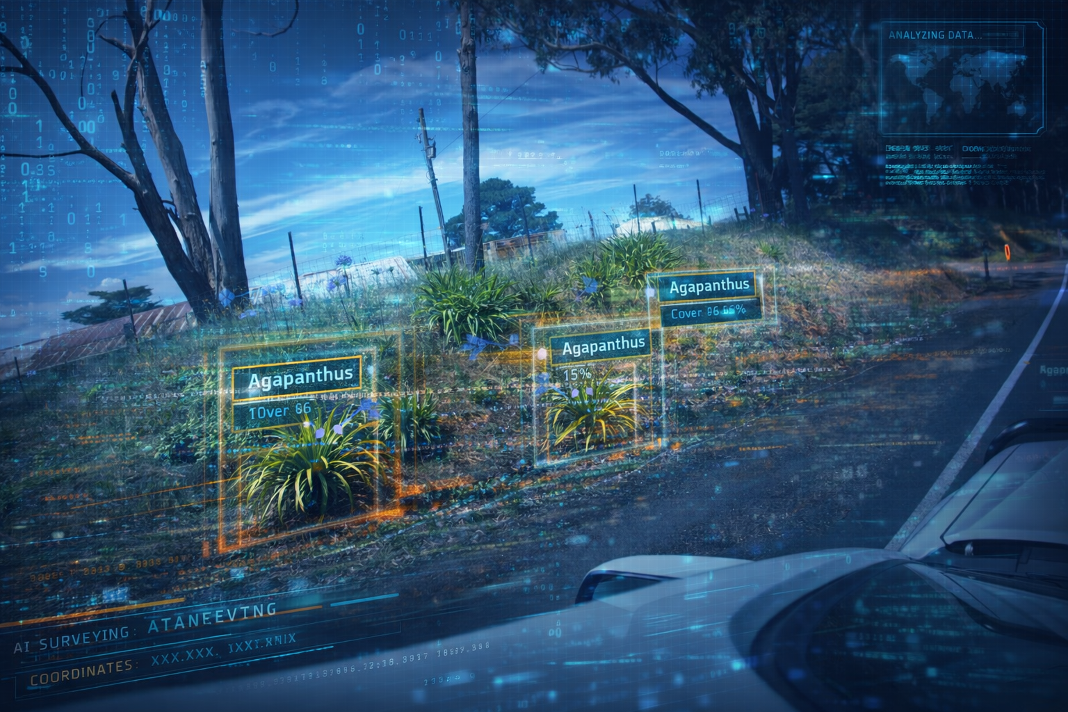
One of the most promising applications we’ve explored is weed surveying using geo-tagged imagery.
Testing AI for Weed Surveys
We recently trialed AI-assisted analysis on a roadside weed survey.
The data collection method was deliberately simple: geo-tagged photographs captured from a moving vehicle along a road corridor. No specialist camera systems, no slowing traffic, and no requirement for expert botanists in the field.
We then asked the AI to analyse each image and answer a set of targeted ecological questions:
Does this image contain Blackberry, Agapanthus, or Thistles?
If present, what is the estimated abundance?
What is the approximate area of occupancy or cover?
What confidence does the model have in that detection?
Rather than asking the AI to “classify everything”, the task was tightly scoped to species of interest and specific attributes relevant to weed management.
After processing the full image set, we were left with:
Locations where target species were detected
Estimates of abundance and cover along the roadside
A spatial dataset that could be mapped, queried, and compared over time
This allowed us to build a continuous picture of weed presence along an entire road, rather than relying on sporadic field observations or subjective visual estimates.
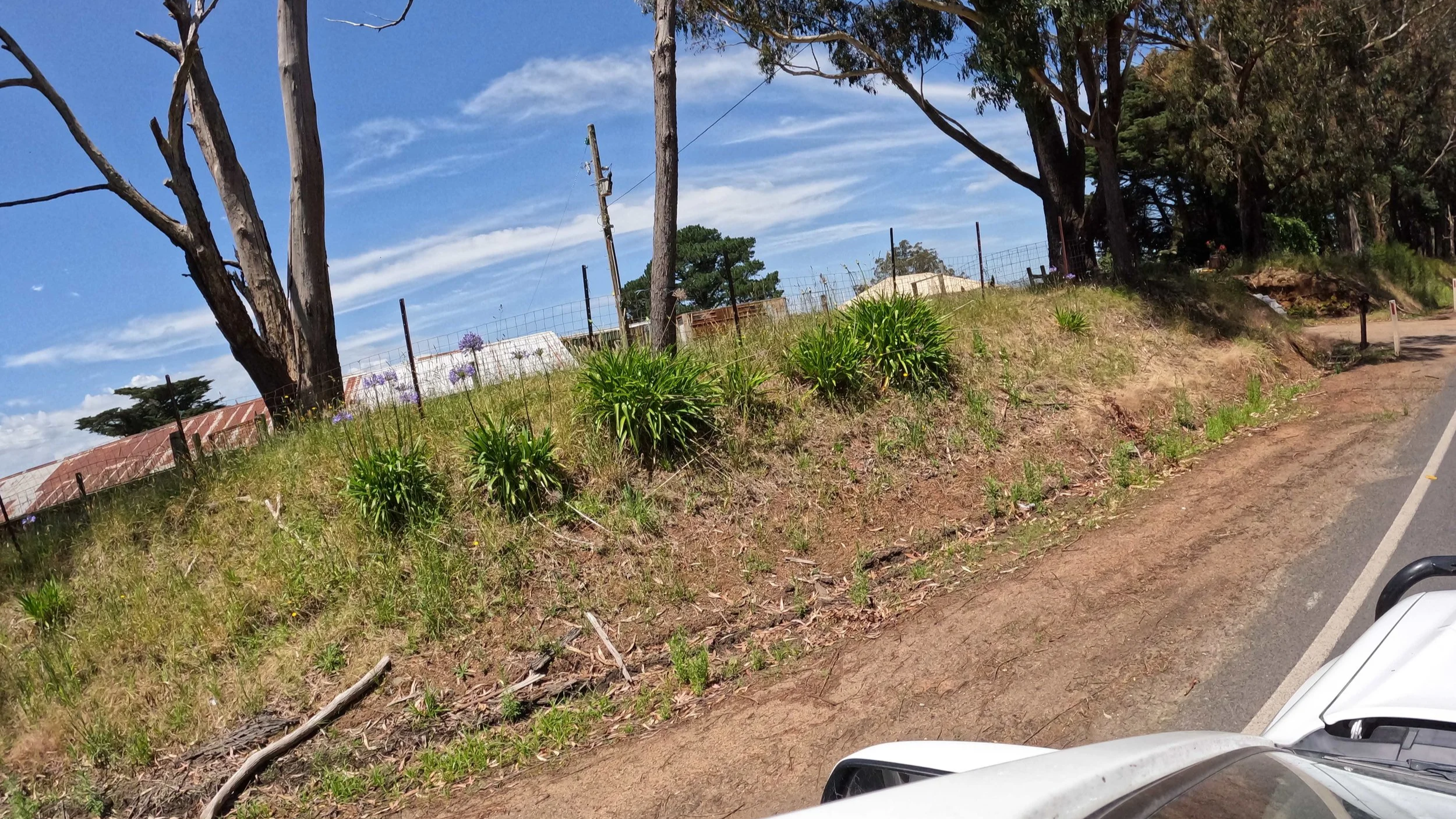
A geo-tagged image fed into our AI test-bed to detect Agapanthus courteously supplied by ID Ecological Management.
Why This Matters
Traditional weed surveys are labour-intensive, subjective, and difficult to repeat consistently. Estimates of cover or abundance can vary significantly between observers, even when using the same methodology.
AI doesn’t replace ecological expertise, it changes where that expertise is applied.
Some key advantages we observed include:
Objective and Repeatable Analysis
Given the same imagery and prompts, the AI produces consistent outputs. This makes it far easier to:
Compare surveys over time
Detect genuine change rather than observer bias
Defend results in compliance or audit contexts
Lower Barrier to Data Collection
Because the interpretation happens after the fact, data can be collected by lower-skilled personnel, contractors, or even autonomous systems such as vehicles or drones. The requirement shifts from “expert in the field” to “repeatable data capture”.
Scalability
Roadsides, reserves, and linear assets are notoriously difficult to survey comprehensively. Image-based capture paired with AI analysis scales far more easily than traditional walk-through assessments.
Traceability
Every detection can be traced back to an image, location, and timestamp. This creates a clear audit trail that is often missing from manual field notes.
Beyond Weed Surveys
While weed detection is a strong early use case, the implications are broader. The same approach can be extended to vegetation condition indicators, presence of key structural features, evidence of disturbance or erosion or infrastructure interactions with ecological assets.
Over time, this opens the door to hybrid workflows, where AI performs large-scale, repeatable screening, ecologists focus on interpretation, validation, and decision-making and field effort is targeted where it adds the most value. Importantly, this also creates opportunities for autonomous or semi-autonomous monitoring, particularly in environments that are dangerous, remote, or logistically complex.
Taking a Responsible Approach
At TerraLab, we’re careful not to overstate what AI can do. AI outputs still need:
Clear scoping and well-designed prompts
Validation against ecological expertise
Transparent reporting of uncertainty and limitations
Used poorly, AI can introduce false confidence. Used well, it becomes a powerful decision-support tool that complements (rather than replaces) professional judgement.
Looking for Partners
We see this as an emerging capability with enormous potential, particularly for organisations responsible for large or dispersed ecological assets.
We’re actively looking to partner with:
Land managers
Councils and agencies
Infrastructure operators
Research and innovation teams
Our goal is to build practical, defensible AI-assisted ecological assessment workflows that can operate at scale and stand up to real-world scrutiny. If your organisation is interested in leading the next phase of ecological assessment or piloting these approaches in a real-world context, we’d love to talk.